NASA Study Maps Shifting Coastal Ground in California, Revealing Future Flood Risks
• 1 min read
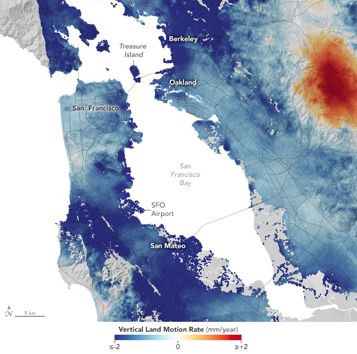
New research from NASA's JPL and NOAA has mapped detailed patterns of rising and sinking land along California's coast using advanced radar technology. The study provides crucial data to help coastal communities prepare for combined threats of ground movement and sea level rise.