New research by NASA's Jet Propulsion Laboratory and NOAA has revealed detailed patterns of rising and sinking land along California's coastline, providing valuable insights for communities facing sea level challenges.
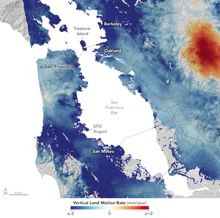
The study, conducted between 2015 and 2023, mapped vertical land movements across major coastal cities including San Francisco, Los Angeles, and San Diego. Using advanced radar technology, researchers identified specific areas where the ground is sinking or rising.
Several factors drive these elevation changes. Human activities like groundwater pumping and wastewater injection influence ground movement, while natural processes such as tectonic activity also play a role. The combination of sinking land and rising seas creates increased flood risks in vulnerable areas.
To capture this detailed view, scientists employed interferometric synthetic aperture radar (InSAR) from European Space Agency satellites. This technique merges multiple 3D observations to detect surface movements as small as fractions of inches. Ground-based satellite monitoring stations provided additional motion data.
The findings highlight locations facing heightened exposure to sea level rise in upcoming decades. This includes specific cities, beaches, and aquifers where sinking land could worsen problems like nuisance flooding and saltwater intrusion into freshwater supplies.
This mapping effort gives coastal communities valuable data to help adapt their infrastructure and planning for future sea level changes. By understanding local elevation trends, cities can better prepare for and respond to evolving coastal conditions.
The research demonstrates how satellite technology can track subtle ground movements across large areas, helping identify at-risk zones before they face serious impacts from rising seas.