Alturas, California
History
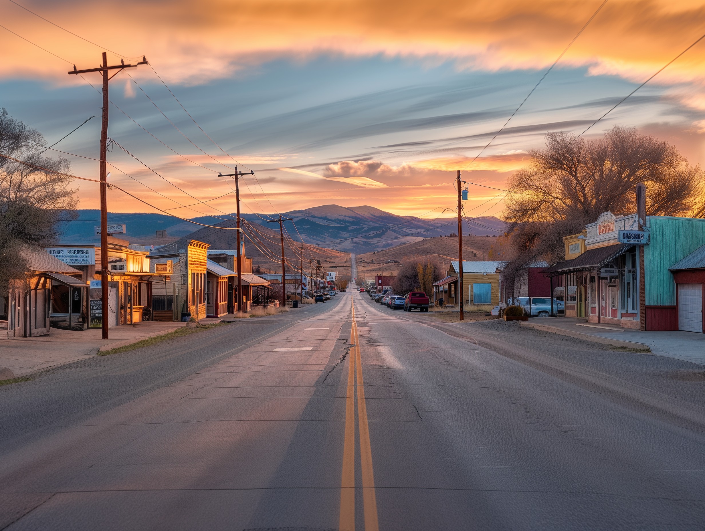
Alturas, California, has a rich history dating back to the mid-19th century when it was originally known as Dorris Bridge. The settlement began to flourish with the establishment of a trading post and later became a key stop for gold miners and settlers moving west. In 1876, the town was renamed Alturas, which means 'heights' in Spanish, reflecting its elevated location. Over the years, Alturas has seen various waves of economic activity, from agriculture and ranching to logging. Today, its historic buildings and landmarks offer a glimpse into the past, preserving the legacy of the pioneers who built the community.
Geography
Situated in the northeastern corner of California, Alturas is the county seat of Modoc County and sits at an elevation of approximately 4,370 feet. The town is surrounded by diverse landscapes, including the Warner Mountains to the east and the expansive Modoc Plateau to the west. This unique geography provides a mix of high desert and forested areas, contributing to a diverse ecosystem. The Pit River flows through Alturas, adding to the scenic beauty of the region. Its remote location makes it a gateway to numerous outdoor activities, such as hiking, fishing, and bird watching, attracting nature enthusiasts year-round.
Demographics
As of the latest census, Alturas, California, has a population of around 2,700 residents. The demographic makeup of the town reflects a predominantly white population, with small percentages of Native American, Hispanic, and other ethnic groups. The community is characterized by a mix of ages, with a notable proportion of residents over the age of 50, indicative of its appeal as a retirement destination. The town's economy is primarily driven by agriculture, government services, and small businesses, providing a stable yet modest lifestyle for its inhabitants. Despite its small size, Alturas fosters a tight-knit community atmosphere, with local events and traditions playing a significant role in daily life.
Geography
Climate
Alturas, California experiences a semi-arid climate characterized by hot, dry summers and cold, snowy winters. The region receives limited rainfall, with most precipitation occurring during the winter months. Summers can see temperatures soaring above 90°F, while winter temperatures often drop below freezing, creating a diverse climate that shapes the local lifestyle and agricultural practices. This climatic variability has historically influenced settlement patterns, with early inhabitants adapting to the seasonal extremes.
Topography
Nestled in the northeastern corner of California, Alturas sits at an elevation of approximately 4,370 feet above sea level. The topography of the area is defined by a mix of high desert plains and mountain ranges, providing a varied landscape that includes rolling hills, valleys, and rugged peaks. This geographic diversity not only offers stunning natural vistas but also supports a range of outdoor activities such as hiking, fishing, and hunting, making it a destination for nature enthusiasts and adventure seekers.
Natural Features
Alturas is surrounded by an array of natural features that contribute to its unique charm and ecological significance. The nearby Modoc National Forest offers a haven for wildlife and a retreat for those seeking solitude in nature. Rivers and lakes dot the landscape, providing vital water sources and recreational opportunities. Additionally, the presence of geothermal features underscores the region's dynamic geological history, attracting scientists and tourists alike to explore its hot springs and volcanic formations.
Alturas, California map with satellite view
Alturas Neighborhood Map
Alturas, a small town nestled in the northeastern corner of California, boasts a neighborhood map that highlights its charming residential areas and local amenities. The map delineates various neighborhoods, showcasing the town's layout and providing a glimpse into the community's structure. Whether you're a resident or a visitor, the map serves as an essential tool for navigating through Alturas' quaint streets, pinpointing schools, parks, and essential services. Its detailed representation helps foster a sense of belonging and familiarity, making it easier to explore and appreciate the unique character of each neighborhood.
Interactive Map of Alturas area
An interactive map of the Alturas area offers a dynamic and engaging way to explore this picturesque town and its surroundings. Users can zoom in and out to get a closer look at specific locations or gain a broader perspective of the region. This tool provides real-time updates and detailed information on local attractions, businesses, and natural landmarks. Whether you're planning a visit or simply curious about the area, the interactive map allows for a personalized experience, enabling users to discover hidden gems and plan their activities with ease.
Free printable PDF Map of Alturas
For those who prefer a traditional approach to navigation, a free printable PDF map of Alturas is available, offering a convenient and accessible resource. This map can be easily downloaded and printed, providing a tangible guide to the town's streets, landmarks, and points of interest. Ideal for travelers, new residents, or anyone looking to explore without relying on digital devices, the PDF map ensures that essential information is always at hand. Its clear and concise layout makes it a valuable tool for anyone seeking to navigate Alturas with confidence.
Modoc county
Alturas serves as the county seat of Modoc County, a region known for its rugged landscapes and rich history. The county encompasses a diverse range of environments, from vast forests and high desert plains to scenic rivers and lakes. A map of Modoc County highlights these features, showcasing the natural beauty and recreational opportunities that draw visitors to the area. In addition to its geographical attributes, the map also points out the various towns and communities within the county, providing a comprehensive overview of this unique and captivating part of California.
Alturas Map | United States Google Satellite Maps
detailed map of Alturas and near places
Navigating the scenic locale of Alturas, California, becomes an immersive experience with a detailed map in hand. The map not only highlights the town's charming streets and essential landmarks but also extends to nearby attractions, offering a comprehensive guide for both residents and visitors. From the rugged beauty of the Modoc National Forest to the tranquil waters of Goose Lake, the map ensures that every notable feature is within reach. Whether you're planning a hiking adventure, a historical tour, or simply want to explore the quaint local shops, this detailed map serves as an indispensable tool for discovering the hidden gems in and around Alturas.
Alturas hotel reservations
Securing a place to stay in Alturas, California, is a breeze with the town's diverse range of hotel options. From cozy bed-and-breakfasts to well-appointed motels, Alturas offers accommodations that cater to various preferences and budgets. Many of these establishments are conveniently located, providing easy access to the town's attractions and natural wonders. Whether you're visiting for a weekend getaway or an extended stay, making a hotel reservation in Alturas ensures a comfortable and welcoming base from which to explore the area's rich history and natural beauty.
Alturas car rental
Exploring Alturas, California, and its surrounding areas is made significantly easier with the convenience of car rentals. Offering flexibility and freedom, car rentals allow visitors to traverse the picturesque landscapes and visit remote attractions that might otherwise be inaccessible. With several rental companies available, travelers can choose from a variety of vehicles to suit their needs, whether it's a rugged SUV for off-road adventures or a compact car for city driving. Renting a car in Alturas provides the perfect solution for those looking to make the most of their visit, ensuring that every corner of this beautiful region can be explored at leisure.
Old Historical Maps of Alturas, CA - Pastmaps
Frequently asked questions about Alturas historical maps
Exploring the historical maps of Alturas offers a fascinating glimpse into the past of this California town. These maps, often sought after by historians, genealogists, and curious locals, reveal how the landscape, infrastructure, and settlement patterns have evolved over the decades. From the early days of railroad expansion to the more recent urban developments, each map tells a unique story. Access to these historical maps can provide valuable insights into the region's growth and changes, making them an indispensable resource for anyone interested in the rich history of Alturas.
Classic USGS Alturas California 7.5'x7.5' Topo Map
The Classic USGS Alturas California 7.5'x7.5' Topo Map is an indispensable tool for outdoor enthusiasts, geologists, and researchers. This detailed topographic map highlights the area's diverse terrain, including its mountains, valleys, and water bodies, with precise contour lines and elevations. Originally produced by the United States Geological Survey, these maps are known for their accuracy and reliability, making them essential for activities such as hiking, camping, and land navigation. The Alturas topo map serves not only as a practical guide but also as a historical artifact, capturing the geographical features of the region at a specific point in time.
More maps available
For those seeking more maps of Alturas, a wealth of resources is available beyond the classic USGS topographic series. Modern digital maps offer interactive features and real-time data, making navigation and exploration more accessible. Historical archives provide older maps that shed light on the town's development over the years. Additionally, thematic maps focusing on aspects like land use, vegetation, and climate can be found through local government offices, libraries, and online repositories. These diverse map offerings cater to a variety of needs, whether for academic research, outdoor activities, or simply satisfying one's curiosity about Alturas.
Elevation of Alturas, CA, USA - Topographic Map
Latitude
Positioned in Northern California, Alturas boasts a latitude of approximately 41.4871° N. This geographical marker situates the town in Modoc County, providing a blend of high desert and forested landscapes. The latitude influences the local climate, bringing a mix of cold winters and warm summers, which is characteristic of regions at this particular northern point. The town’s latitude also places it within a region rich in natural beauty, from the Warner Mountains to the expansive Modoc National Forest, making it a fascinating spot for geographic enthusiasts and nature lovers alike.
Elevation
Alturas, California is perched at an elevation of about 4,370 feet (1,332 meters) above sea level, contributing to its unique environmental and climatic conditions. This higher elevation means that residents and visitors experience cooler average temperatures compared to many other parts of California. The elevation not only affects the weather but also the types of vegetation and wildlife found in the area, making it a unique ecological zone. The elevation provides stunning vistas of the surrounding valleys and mountains, enhancing its appeal as a destination for outdoor activities such as hiking and birdwatching.
Barometric Pressure
In Alturas, the barometric pressure typically hovers around an average of 30 inches of mercury (Hg), reflecting its elevation and geographic location. Barometric pressure is a crucial factor in weather prediction and can influence local climate patterns, including the likelihood of precipitation and storm development. Changes in barometric pressure can also affect individuals, sometimes causing discomfort or health issues such as headaches for those sensitive to pressure fluctuations. Understanding the barometric pressure trends in Alturas is valuable for both meteorologists and residents who rely on accurate weather forecasting for agriculture and daily activities.
Alturas, CA - Geographic Facts & Maps - MapSof.net
Quick Facts about Alturas
Nestled in the northeastern corner of California, Alturas serves as the county seat of Modoc County and offers a rich tapestry of history and natural beauty. Known for its agricultural roots and close-knit community, this small town boasts a unique blend of rural charm and modern amenities. Despite its modest size, Alturas is a hub for outdoor activities, attracting visitors with its proximity to the Modoc National Forest and various wildlife refuges. The town's historical significance is also evident, with numerous landmarks and annual events that celebrate its heritage.
Geography
Alturas is situated in a picturesque valley surrounded by expansive plains, rolling hills, and rugged mountain ranges. The town is positioned at an elevation of approximately 4,370 feet, providing a unique climate characterized by warm summers and cold, snowy winters. The nearby Warner Mountains and the Modoc National Forest offer a striking backdrop to the region, making it a haven for outdoor enthusiasts. Alturas' geography not only defines its stunning landscapes but also influences its agricultural practices, with vast farmlands and ranches dotting the area.
Demographics
With a population of just over 2,500 residents, Alturas exemplifies small-town America where community ties run deep. The demographics reflect a predominantly White population, with a mix of other ethnicities contributing to the town's cultural fabric. The median age in Alturas skews higher, indicative of a significant number of retirees who find solace in its tranquil environment. Despite its size, the town boasts a variety of services and facilities aimed at fostering a tight-knit community, from local schools to healthcare centers, and a range of local businesses that support the economy.